Arbirlot Parish Kirk
Introduction
The photograph on this page of Arbirlot Parish Kirk by Anne Burgess as part of the Geograph project.
The Geograph project started in 2005 with the aim of publishing, organising and preserving representative images for every square kilometre of Great Britain, Ireland and the Isle of Man.

There are currently over 7.5m images from over 14,400 individuals and you can help contribute to the project by visiting https://www.geograph.org.uk
Arbirlot Parish Kirk
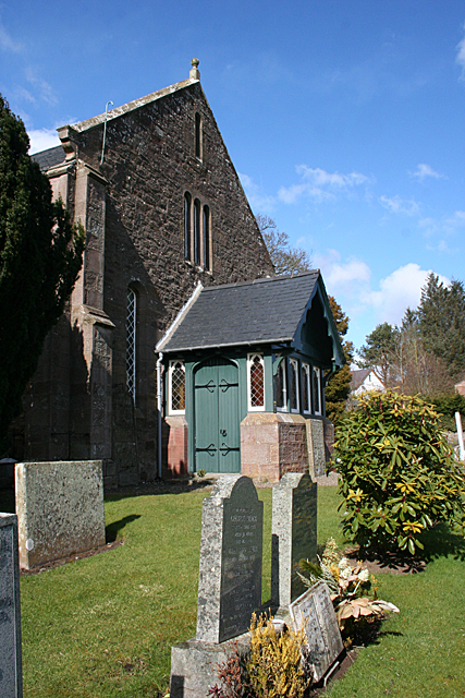
Image: © Anne Burgess Taken: 27 Mar 2013
The elaborate porch is clearly a later addition to the plain original building.
Images are licensed for reuse under creativecommons.org/licenses/by-sa/2.0
Image Location
Latitude
56.555227
Longitude
-2.649543