Walled garden at Trewidden
Introduction
The photograph on this page of Walled garden at Trewidden by David Smith as part of the Geograph project.
The Geograph project started in 2005 with the aim of publishing, organising and preserving representative images for every square kilometre of Great Britain, Ireland and the Isle of Man.

There are currently over 7.5m images from over 14,400 individuals and you can help contribute to the project by visiting https://www.geograph.org.uk
Walled garden at Trewidden
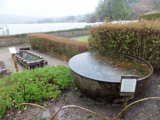
Image: © David Smith Taken: 21 Mar 2013
In the foreground is a tin boiling kettle, an iron bowl used for purifying tin. Most such kettles were melted for scrap in the second world war, but there are a few at Trewidden which were either lost in the gardens or used as planters. Beyond, on the left of the picture, are two horizontal vine troughs. These were used to force grapes under glass. The vine was rooted at the lower end and trained along the trough. These are, perhaps, unique in Britain. We don't know how much damage was caused to the backs of the gardeners assigned to tend the vines.
Images are licensed for reuse under creativecommons.org/licenses/by-sa/2.0
Image Location


Leaflet Map data © OpenStreetMap
Latitude
50.110575
Longitude
-5.577886