The rear of Downshire Road Presbyterian Church, Newry
Introduction
The photograph on this page of The rear of Downshire Road Presbyterian Church, Newry by Eric Jones as part of the Geograph project.
The Geograph project started in 2005 with the aim of publishing, organising and preserving representative images for every square kilometre of Great Britain, Ireland and the Isle of Man.

There are currently over 7.5m images from over 14,400 individuals and you can help contribute to the project by visiting https://www.geograph.org.uk
The rear of Downshire Road Presbyterian Church, Newry
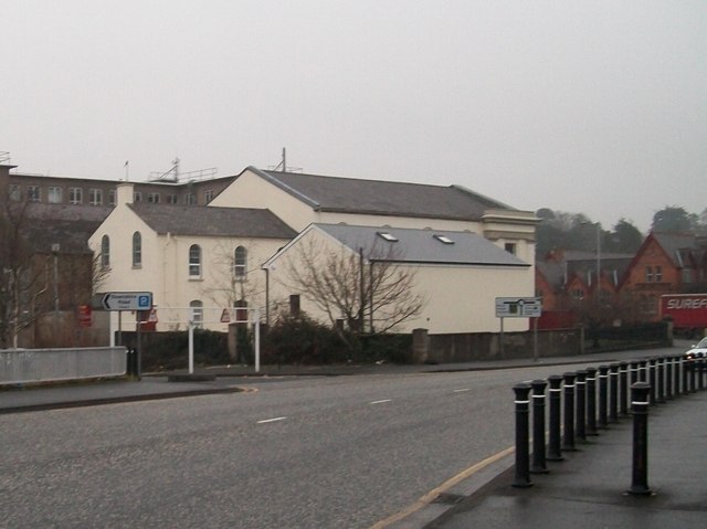
Image: © Eric Jones Taken: 31 Dec 2010
This church stand across the road from Newry Courthouse, the target of a number of republican car bombings - the bollards on the right have been added in an attempt to further protect the well defended courthouse. The church - minus blast walls and bollards - has suffered more damage from these attacks than the intended target. On the night of February 22nd, 2010, damage estimated at £350,000 was caused to the church when a dissidents' device exploded outside the Courthouse. http://www.belfasttelegraph.co.uk/news/local-national/northern-ireland/newry-congregation-overjoyed-as-bombed-church-rises-again-28590748.html http://en.wikipedia.org/wiki/Newry_car_bombing
Images are licensed for reuse under creativecommons.org/licenses/by-sa/2.0
Image Location
Latitude
54.179941
Longitude
-6.334692