Disused crofting land near Tongue
Introduction
The photograph on this page of Disused crofting land near Tongue by AlastairG as part of the Geograph project.
The Geograph project started in 2005 with the aim of publishing, organising and preserving representative images for every square kilometre of Great Britain, Ireland and the Isle of Man.

There are currently over 7.5m images from over 14,400 individuals and you can help contribute to the project by visiting https://www.geograph.org.uk
Disused crofting land near Tongue
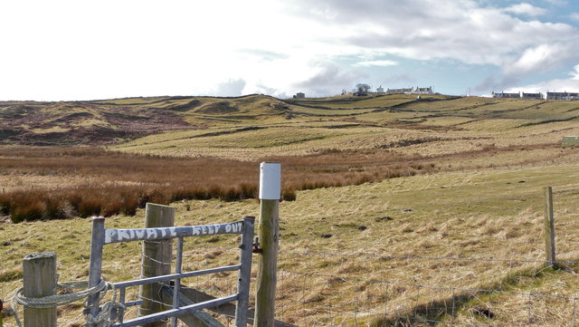
Image: © AlastairG Taken: 20 Mar 2013
When the croft was being worked, the land would have been drained into the small burn which flows out onto Skinnet beach. The presence of rushes suggests that the drains have been neglected and as a result the land has become much wetter. The sign on the gate beside the path to the beach is pretty meaningless. It was written either by someone who wasn't clued up on Scottish access legislation or who was hoping that the visitors weren't!
Images are licensed for reuse under creativecommons.org/licenses/by-sa/2.0
Image Location
Latitude
58.520129
Longitude
-4.420176