The Parrot Pub, Canterbury
Introduction
The photograph on this page of The Parrot Pub, Canterbury by David Anstiss as part of the Geograph project.
The Geograph project started in 2005 with the aim of publishing, organising and preserving representative images for every square kilometre of Great Britain, Ireland and the Isle of Man.

There are currently over 7.5m images from over 14,400 individuals and you can help contribute to the project by visiting https://www.geograph.org.uk
The Parrot Pub, Canterbury
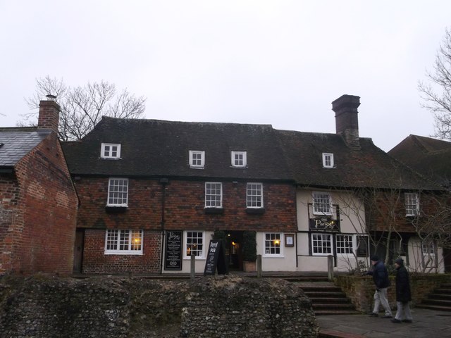
Image: © David Anstiss Taken: 23 Mar 2013
This is also St Radigund's Hall (a Grade II listed former Wealden Hall) on Church Lane. In 1937 it was nearly demolished, then saved and converted into a Girl's Club, then a restaurant and then pub (now incorporated into the Shepherd Neame group). In the foreground is part of the ruins of the city walls of Canterbury. See also Image See http://www.britishlistedbuildings.co.uk/en-170574-st-radigund-hall-kent for more details about the listed hall.
Images are licensed for reuse under creativecommons.org/licenses/by-sa/2.0
Image Location
Latitude
51.282325
Longitude
1.082459