
Glebe Farmhouse and gate piers, Crowan
Introduction
The photograph on this page of Glebe Farmhouse and gate piers, Crowan by Humphrey Bolton as part of the Geograph project.
The Geograph project started in 2005 with the aim of publishing, organising and preserving representative images for every square kilometre of Great Britain, Ireland and the Isle of Man.

There are currently over 7.5m images from over 14,400 individuals and you can help contribute to the project by visiting https://www.geograph.org.uk
Glebe Farmhouse and gate piers, Crowan
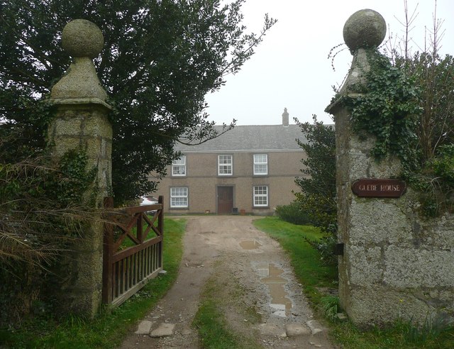
Image: © Humphrey Bolton Taken: 2 Mar 2012
The house and gate piers are Grade II listed. The house was formerly the rectory, until a new vicarage was built on a different site in 1888, and is an unusually unaltered example of a 17C rectory although with some later extension and remodelling. The gate piers and flanking walls were also built in (circa) the late 17C. The granite ashlar piers are integral with coursed granite walls at either side. The piers are square on plan where they rise above the walls and have cavetto moulded cornices to ogee-shaped caps with ball finials. (National Heritage Listing)
Images are licensed for reuse under creativecommons.org/licenses/by-sa/2.0
Image Location

Latitude
50.163612
Longitude
-5.296986