The Buthay plaque, Royal Wootton Bassett
Introduction
The photograph on this page of The Buthay plaque, Royal Wootton Bassett by Jaggery as part of the Geograph project.
The Geograph project started in 2005 with the aim of publishing, organising and preserving representative images for every square kilometre of Great Britain, Ireland and the Isle of Man.

There are currently over 7.5m images from over 14,400 individuals and you can help contribute to the project by visiting https://www.geograph.org.uk
The Buthay plaque, Royal Wootton Bassett
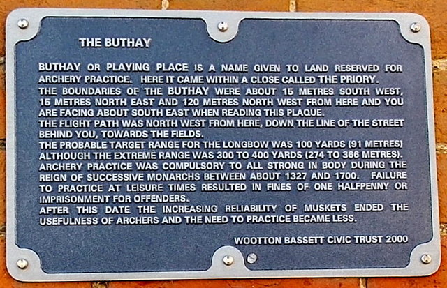
Image: © Jaggery Taken: 2 Feb 2013
The plaque is on the wall of The Croft. http://www.geograph.org.uk/photo/3378590 It records the former use of this area for archery practice.
Images are licensed for reuse under creativecommons.org/licenses/by-sa/2.0
Image Location
Latitude
51.541362
Longitude
-1.906659