Bramcote NG9, Notts.
Introduction
The photograph on this page of Bramcote NG9, Notts. by David Hallam-Jones as part of the Geograph project.
The Geograph project started in 2005 with the aim of publishing, organising and preserving representative images for every square kilometre of Great Britain, Ireland and the Isle of Man.

There are currently over 7.5m images from over 14,400 individuals and you can help contribute to the project by visiting https://www.geograph.org.uk
Bramcote NG9, Notts.
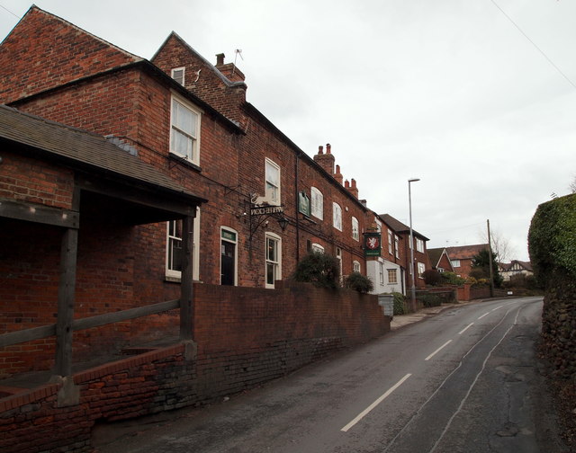
Image: © David Hallam-Jones Taken: 21 Mar 2013
An unusual covered stretch of pavement outside the White Lion pub on Town Street. "Top House", as the pub is sometimes called - because of it being the highest pub in the locality - is a Grade II-listed building that originated in the mid-18th century. Over the brow of the hill lies a junction at the side of which the tower of the former 14th parish church (a.k.a. The Sunken Church) can still be seen in its former graveyard.
Images are licensed for reuse under creativecommons.org/licenses/by-sa/2.0
Image Location
Latitude
52.9344
Longitude
-1.246538