Bramcote NG9, Notts.
Introduction
The photograph on this page of Bramcote NG9, Notts. by David Hallam-Jones as part of the Geograph project.
The Geograph project started in 2005 with the aim of publishing, organising and preserving representative images for every square kilometre of Great Britain, Ireland and the Isle of Man.

There are currently over 7.5m images from over 14,400 individuals and you can help contribute to the project by visiting https://www.geograph.org.uk
Bramcote NG9, Notts.
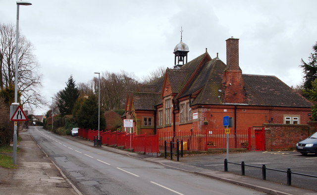
Image: © David Hallam-Jones Taken: 21 Mar 2013
This former junior and infants school at the junction of Church Street (opposite where the car is parked on the side of the road further up the hill) and Town Street is now a privately-owned day nursery. The busy intersection of several main roads near Bramcote Leisure Centre lies two minutes walk away behind the photographer. St John's Theological College is situated three to four minutes walk away over the brow of this hill.
Images are licensed for reuse under creativecommons.org/licenses/by-sa/2.0
Image Location
Latitude
52.934948
Longitude
-1.247868