Clydebank railway station
Introduction
The photograph on this page of Clydebank railway station by Nigel Thompson as part of the Geograph project.
The Geograph project started in 2005 with the aim of publishing, organising and preserving representative images for every square kilometre of Great Britain, Ireland and the Isle of Man.

There are currently over 7.5m images from over 14,400 individuals and you can help contribute to the project by visiting https://www.geograph.org.uk
Clydebank railway station
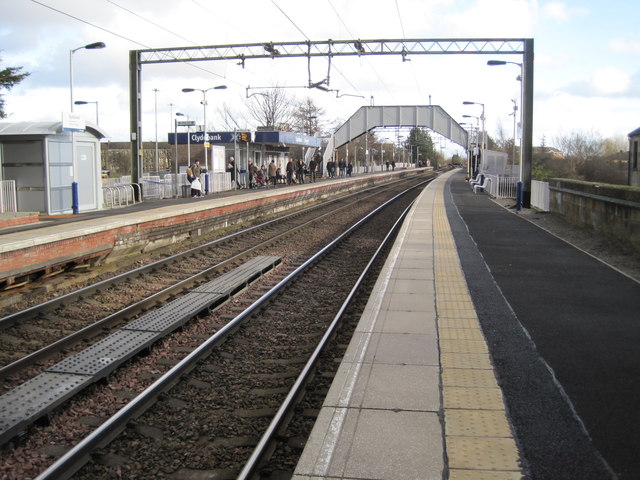
Image: © Nigel Thompson Taken: 15 Mar 2013
Opened in 1897 by the North British Railway, this station was on the extension of the Glasgow Yoker and Clydebank Railway to Dalmuir. Whilst it might have been expected that the original Clydebank East terminus station might have closed upon the opening of this through line, it actually remained in use until 1959. View east towards Yoker and Glasgow.
Images are licensed for reuse under creativecommons.org/licenses/by-sa/2.0
Image Location
Latitude
55.900502
Longitude
-4.40437