Sheepfield and Football Pitch
Introduction
The photograph on this page of Sheepfield and Football Pitch by John S Turner as part of the Geograph project.
The Geograph project started in 2005 with the aim of publishing, organising and preserving representative images for every square kilometre of Great Britain, Ireland and the Isle of Man.

There are currently over 7.5m images from over 14,400 individuals and you can help contribute to the project by visiting https://www.geograph.org.uk
Sheepfield and Football Pitch
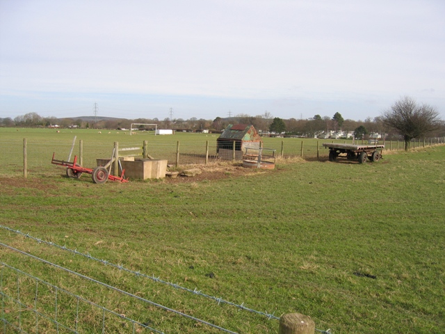
Image: © John S Turner Taken: 13 Feb 2007
Viewed from the lane and footpath past The Blorant. The water trough is placed in the middle of the fence to allow access for the animals from both sides, and the small tin hut is to provide some protection for the feed stuffs. Alongside the fence is an old hay cart. On the other side of the fence is the local football field, and in the distance, to the right and in the next square, is a static caravan site.
Images are licensed for reuse under creativecommons.org/licenses/by-sa/2.0
Image Location
Latitude
53.24867
Longitude
-3.320615