Bulging churchyard wall
Introduction
The photograph on this page of Bulging churchyard wall by Stephen Craven as part of the Geograph project.
The Geograph project started in 2005 with the aim of publishing, organising and preserving representative images for every square kilometre of Great Britain, Ireland and the Isle of Man.

There are currently over 7.5m images from over 14,400 individuals and you can help contribute to the project by visiting https://www.geograph.org.uk
Bulging churchyard wall
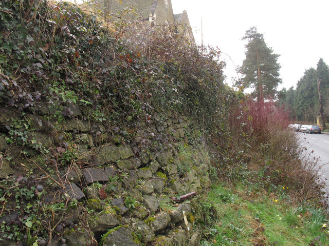
Image: © Stephen Craven Taken: 18 Mar 2013
This churchyard wall, believed to have been built c.1770 when the road past the parish church was improved as a turnpike road, used to be vertical but a 14 metre length of it is now bulging. At the time of taking this photo, options were being considered for how to stabilise it. The extent of the movement can be judged by comparison with the unaffected length of wall behind the tree in the background.
Images are licensed for reuse under creativecommons.org/licenses/by-sa/2.0
Image Location
Latitude
51.261021
Longitude
0.011827