
Part of the former British Sugar site, Stourport Road, Kidderminster
Introduction
The photograph on this page of Part of the former British Sugar site, Stourport Road, Kidderminster by P L Chadwick as part of the Geograph project.
The Geograph project started in 2005 with the aim of publishing, organising and preserving representative images for every square kilometre of Great Britain, Ireland and the Isle of Man.

There are currently over 7.5m images from over 14,400 individuals and you can help contribute to the project by visiting https://www.geograph.org.uk
Part of the former British Sugar site, Stourport Road, Kidderminster
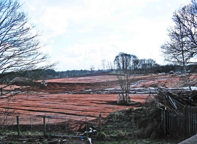
Image: © P L Chadwick Taken: 18 Mar 2013
This is just a very small part of the former British Sugar Corporation site, which had a long frontage to Stourport Road (the A451) and stretched back to its boundary with the line of the Staffs & Worcs Canal. It was used as a sugar beet processing and production plant for many decades but closed some years ago, thanks mainly to increasing competition from imported sugar cane. It was well-known for the unattractive smells that emanated from the factory and when the wind was in a certain direction could be experienced in neighbouring Stourport-on-Severn. In recent weeks most, but not all, of the many buildings on the site have been flattened. Much hazardous waste has had be removed. The site is planned to be used for "mixed development" but in the present economic climate it seems probable that this will be phased over some years. Some very evocative photographs by Elle Dunn of the closed factory, both exterior and interior and in colour and monochrome, can be seen on a website called contaminationzone.
Images are licensed for reuse under creativecommons.org/licenses/by-sa/2.0
Image Location

Latitude
52.370509
Longitude
-2.260368