The M1 at Kilmore near Moira (1980)
Introduction
The photograph on this page of The M1 at Kilmore near Moira (1980) by Albert Bridge as part of the Geograph project.
The Geograph project started in 2005 with the aim of publishing, organising and preserving representative images for every square kilometre of Great Britain, Ireland and the Isle of Man.

There are currently over 7.5m images from over 14,400 individuals and you can help contribute to the project by visiting https://www.geograph.org.uk
The M1 at Kilmore near Moira (1980)
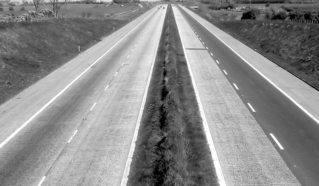
Image: © Albert Bridge Taken: 4 May 1980
The view towards Belfast, from the flyover on the Bridge Road, showing a lightly-used M1 in the days before the provision of a crash barrier in the central reservation. This section opened in 1966 and is just west of where the railway and the motorway run parallel for about two miles.
Images are licensed for reuse under creativecommons.org/licenses/by-sa/2.0
Image Location
Latitude
54.491732
Longitude
-6.278516