Auchincarroch Road
Introduction
The photograph on this page of Auchincarroch Road by Lairich Rig as part of the Geograph project.
The Geograph project started in 2005 with the aim of publishing, organising and preserving representative images for every square kilometre of Great Britain, Ireland and the Isle of Man.

There are currently over 7.5m images from over 14,400 individuals and you can help contribute to the project by visiting https://www.geograph.org.uk
Auchincarroch Road
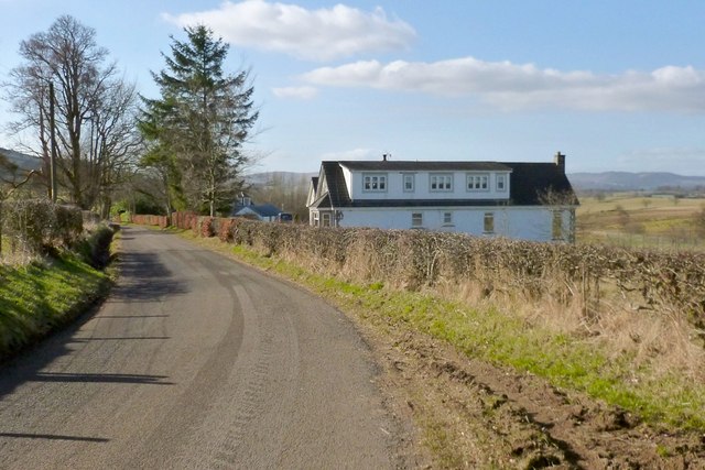
Image: © Lairich Rig Taken: 1 Mar 2013
Of the two buildings visible beside the road, the more distant one is Croftfoot, on the same site as a Croftfoot that is depicted on the first-edition OS map (surveyed in 1860). The nearer building is the more recent "Thrid". A very helpful gentleman from this area informed me that the name "Thrid" was taken from a ruin nearby, of which only low footings remain. The Canmore archaeology database lists a couple of such ruins, the nearest of them at NS 437 827, probably a reference to ruins that can be seen at Image I suspect that the name of that ruined building, in turn, owes something to the "Third of Blairwhomry" that is shown on Roy's Military Survey of Scotland (1740s-50s). [(*) Roy's map also shows "Blairwhomry" (i.e. Image), close to, but distinct from, "Third of Blairwhomry". Blairquhomrie is also depicted, as Blairchoymry, on the even earlier Pont/Blaeu map of the Lennox. On why there are so many "Blair-" names in this area, see Image]
Images are licensed for reuse under creativecommons.org/licenses/by-sa/2.0
Image Location
Latitude
56.014676
Longitude
-4.50661