Benchmark and Flood Mark, Delph
Introduction
The photograph on this page of Benchmark and Flood Mark, Delph by michael ely as part of the Geograph project.
The Geograph project started in 2005 with the aim of publishing, organising and preserving representative images for every square kilometre of Great Britain, Ireland and the Isle of Man.

There are currently over 7.5m images from over 14,400 individuals and you can help contribute to the project by visiting https://www.geograph.org.uk
Benchmark and Flood Mark, Delph
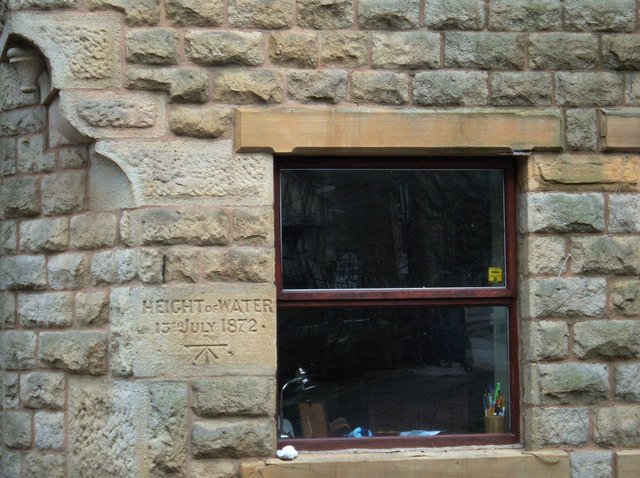
Image: © michael ely Taken: 13 Feb 2007
This stone cottage is situated near the bridge in the centre of Delph on the north bank of the River Tame. A stone has been inscribed with the height of the flood of 13th July 1872 together with an Ordnance Survey benchmark symbol.
Images are licensed for reuse under creativecommons.org/licenses/by-sa/2.0
Image Location
Latitude
53.567707
Longitude
-2.02563