Former pub, Lower Holloway
Introduction
The photograph on this page of Former pub, Lower Holloway by David Anstiss as part of the Geograph project.
The Geograph project started in 2005 with the aim of publishing, organising and preserving representative images for every square kilometre of Great Britain, Ireland and the Isle of Man.

There are currently over 7.5m images from over 14,400 individuals and you can help contribute to the project by visiting https://www.geograph.org.uk
Former pub, Lower Holloway
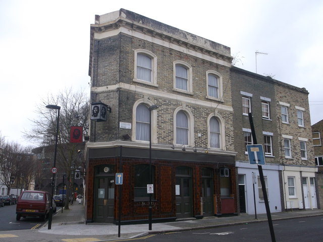
Image: © David Anstiss Taken: 10 Mar 2013
This public house on the junction of Lowman Road and Annette Road (on the right) was called 'El Comandante' a few years ago. Formerly it was the Lord Palmerston, clues to its reinvention are subtle: a small poster in the window and the glass in the old Watney's lantern replaced with something a little more, well, revolutionary. Essentially, this was a South American bar in an old pub.
Images are licensed for reuse under creativecommons.org/licenses/by-sa/2.0
Image Location
Latitude
51.555449
Longitude
-0.112827