Dalgain
Introduction
The photograph on this page of Dalgain by Bob Forrest as part of the Geograph project.
The Geograph project started in 2005 with the aim of publishing, organising and preserving representative images for every square kilometre of Great Britain, Ireland and the Isle of Man.

There are currently over 7.5m images from over 14,400 individuals and you can help contribute to the project by visiting https://www.geograph.org.uk
Dalgain
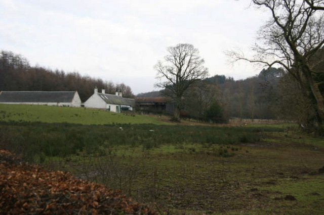
Image: © Bob Forrest Taken: 6 Feb 2007
Dalgain shows the typical layout of the farmstead of a tenant dairy farmer in this part of Ayrshire. The gable end of the main dwelling faces the prevailing wind with usually a byre, barn and a granary making a L-shape building around the 'farm close'. An additional building for storing machinery, providing a workshop facility or additional byre space, was often added when needed. This property lies above the floodplain of the R. Ayr near the private road leading to Glen Logan House.
Images are licensed for reuse under creativecommons.org/licenses/by-sa/2.0
Image Location
Latitude
55.509797
Longitude
-4.282128