Stonework Architectural
Introduction
The photograph on this page of Stonework Architectural by MDS as part of the Geograph project.
The Geograph project started in 2005 with the aim of publishing, organising and preserving representative images for every square kilometre of Great Britain, Ireland and the Isle of Man.

There are currently over 7.5m images from over 14,400 individuals and you can help contribute to the project by visiting https://www.geograph.org.uk
Stonework Architectural
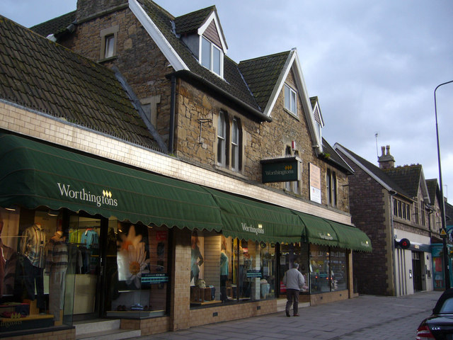
Image: © MDS Taken: 12 Feb 2007
The context of Architecture Portishead High Street. These stone and cut formed lintel and pillar houses became small shops and then stores until 2006 when proposals were made to alter the History and Quality of Portishead central to meet Corporate demands for emporia. At date the Architecture and therefore the History remain as a frontage, although badly damaged by protrusions and pigeon fencing, however under Heritage Regulations it should be possible for these to be cleaned up to a clear face and the stonework retained in the new development proposed for the shop site which can easily fit behind the main walls and windows, it facing a modern open car park, main road and another proposed multi-store complex and the Health Centre, into the back gardens of these houses. The built form is stable. Comments and advice, from concerned residents and visitors to this Historic town, could be made to North Somerset District Council at Weston Super Mare, Planning. There are several other different styles that need photographic record, this is just one of the better in quality.
Images are licensed for reuse under creativecommons.org/licenses/by-sa/2.0
Image Location
Latitude
51.483583
Longitude
-2.768249