The Foresters
Introduction
The photograph on this page of The Foresters by Ian Capper as part of the Geograph project.
The Geograph project started in 2005 with the aim of publishing, organising and preserving representative images for every square kilometre of Great Britain, Ireland and the Isle of Man.

There are currently over 7.5m images from over 14,400 individuals and you can help contribute to the project by visiting https://www.geograph.org.uk
The Foresters
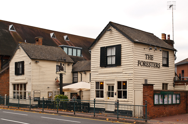
Image: © Ian Capper Taken: 6 Nov 2011
Originally a pair of houses, it is first recorded as a pub in 1882. Only the right hand side was used as such, with the left hand side being first a shop and later a cafe. It was not until 1988 that the pub was extended into the whole building. Originally known as the Foresters Arms, the Arms suffix has since been dropped. Locally listed.
Images are licensed for reuse under creativecommons.org/licenses/by-sa/2.0
Image Location
Latitude
51.172023
Longitude
-0.1641