Mary Street
Introduction
The photograph on this page of Mary Street by Gerald England as part of the Geograph project.
The Geograph project started in 2005 with the aim of publishing, organising and preserving representative images for every square kilometre of Great Britain, Ireland and the Isle of Man.

There are currently over 7.5m images from over 14,400 individuals and you can help contribute to the project by visiting https://www.geograph.org.uk
Mary Street
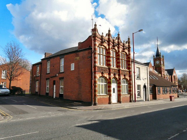
Image: © Gerald England Taken: 13 Mar 2013
On the corner of Mary Street and King Street is the former Openshaw Brewery Company's Newmarket Tavern Image which closed in 2006. In the background is the Town Hall Image
Images are licensed for reuse under creativecommons.org/licenses/by-sa/2.0
Image Location
Latitude
53.478329
Longitude
-2.093078