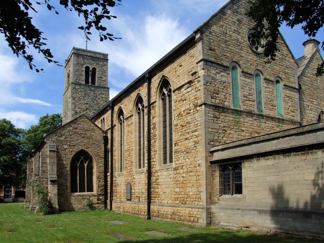
The Church of St Peter-at-Gowts and St Andrew
Introduction
The photograph on this page of The Church of St Peter-at-Gowts and St Andrew by Dave Hitchborne as part of the Geograph project.
The Geograph project started in 2005 with the aim of publishing, organising and preserving representative images for every square kilometre of Great Britain, Ireland and the Isle of Man.
There are currently over 7.5m images from over 14,400 individuals and you can help contribute to the project by visiting https://www.geograph.org.uk

Image: © Dave Hitchborne Taken: 1 Jul 2008
The church has this to say on its website - A Brief Chronology of St Peter-at-Gowts Church. 100 - The excavations at St Mary's Guildhall, immediately north of St Peter-at-Gowts church, revealed evidence of 1st - 5th-century Romano-British occupation on that site, including two timber-framed buildings dating to the 3rd - 5th-century. A "possible" winged Romano-British deity (Arimanius) is depicted on a re-used carved stone that is set high in the western face of the church tower. 11th-century - The church consisted of a nave and chancel only; the western end of the nave, to this day, retains its distinctive Anglo-Saxon "long-and-short" quoins (cornerstones). 1066 - A tower was added to the western end of the nave, sometime in the late 11th-century. The construction of the tower, and the consequent westerly extension of the churchyard, in turn contributed to slightly modifying the alignment of the High Street. 12th-century - A north aisle had been added; and the chancel extended, which (judging by the pre-1852 plan) was slightly longer than the Nave. Both of these structural additions were thus in the Norman style. 13th-century - The south aisle was added. 1347 - The south chapel was founded at the east end of the south aisle by Ralph Jolif (Radulphus Jolyf); a Lincoln merchant. 1560 - There were 58 families residing in the parish. 1780 - The effigies of Ralph Jolif and his wife Amicia were removed from the south chapel. 1848 - The railway arrives in Lincoln and the parish population size consequently rises. 1872 - The church receives six bells from Mears & Stainbank Founders, London. 1845 - The church's west door (in the tower) had been unblocked and restored, by this date. 1852 - Under the supervision of W.A. Nicholson, the church underwent a major period of renovation (1852-1853), which involved adding a new (replacement) north aisle and modifications to the chancel. 1883 - The nearby Ecclesiastical parish of St Andrew was established. 1887 - The church underwent a second period of major restoration in 1887-1888, under the direction of Charles Hodgson Fowler. The chancel was rebuilt/extended and a two-storey north east chapel/organ chamber was also added. It was at St Peter-at-Gowts church (4th December 1887), that Bishop Edward King was reported by some parishioners and prosecuted (1888-1890) for "Ritualistic Practices"; firstly before the Archbishop of Canterbury, Edward White Benson, and then, on appeal, before the Judicial Committee of the Privy Council. 1920 - The rood cross and the war memorial tablet (on the south wall of the nave) were erected. They were the last work of the architect Mr Temple Moore. 1968 - The church of St Andrew was closed and demolished. 1980 - The St Peter-at-Gowts parish became known as the parish of St Peter-at-Gowts and St Andrew. 1984 - The area beneath the organ gallery was re-ordered into a chapel dedicated to St Andrew. The area was carpeted by the Parochial Church Council and the altar table (dated 1671) was given to St Peter's by the Revd. Canon P.C. Hawker, Vicar of the neighbouring parish of St Botolph by Bargate. The chapel was dedicated by The Bishop of Grantham on May 6th 1984. The PCC sold their mission church in Vernon Street and purchased a long lease on the South Range of the St Mary's Guildhall complex and paid for its restoration to become St Peter-at-Gowts' Church Hall.

