Lock No 54 at Stratford-upon-Avon, Warwickshire
Introduction
The photograph on this page of Lock No 54 at Stratford-upon-Avon, Warwickshire by Roger D Kidd as part of the Geograph project.
The Geograph project started in 2005 with the aim of publishing, organising and preserving representative images for every square kilometre of Great Britain, Ireland and the Isle of Man.

There are currently over 7.5m images from over 14,400 individuals and you can help contribute to the project by visiting https://www.geograph.org.uk
Lock No 54 at Stratford-upon-Avon, Warwickshire
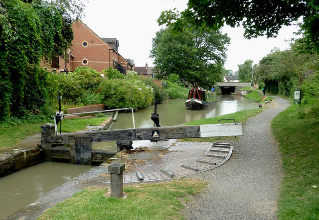
Image: © Roger D Kidd Taken: 24 Aug 2012
Both ground paddles are up, allowing water into the lock chamber in readiness for the approaching narrowboat. There is a flight of four locks up through Stratford from Bancroft Basin, this being the second. It provides a rise of 6ft 9in (about two metres) in water level.
Images are licensed for reuse under creativecommons.org/licenses/by-sa/2.0
Image Location
Latitude
52.194666
Longitude
-1.703851