The Boundary, Guide Bridge
Introduction
The photograph on this page of The Boundary, Guide Bridge by John Topping as part of the Geograph project.
The Geograph project started in 2005 with the aim of publishing, organising and preserving representative images for every square kilometre of Great Britain, Ireland and the Isle of Man.

There are currently over 7.5m images from over 14,400 individuals and you can help contribute to the project by visiting https://www.geograph.org.uk
The Boundary, Guide Bridge
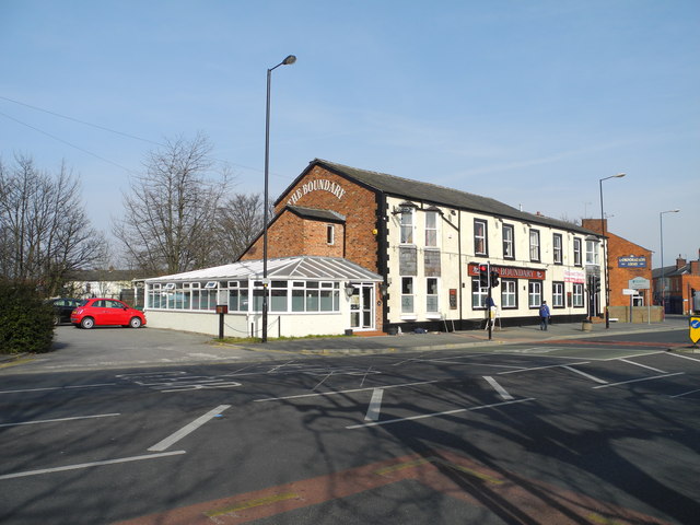
Image: © John Topping Taken: 4 Mar 2013
Formerly The Railway, re-named during the 1970’s to The Boundary. The pub is having a paint job done on the window frames, having recently re-opened on 14-1-13. See Gerald England's photo for more information.
Images are licensed for reuse under creativecommons.org/licenses/by-sa/2.0
Image Location
Latitude
53.475523
Longitude
-2.115069