Red Hill
Introduction
The photograph on this page of Red Hill by Nigel Mykura as part of the Geograph project.
The Geograph project started in 2005 with the aim of publishing, organising and preserving representative images for every square kilometre of Great Britain, Ireland and the Isle of Man.

There are currently over 7.5m images from over 14,400 individuals and you can help contribute to the project by visiting https://www.geograph.org.uk
Red Hill
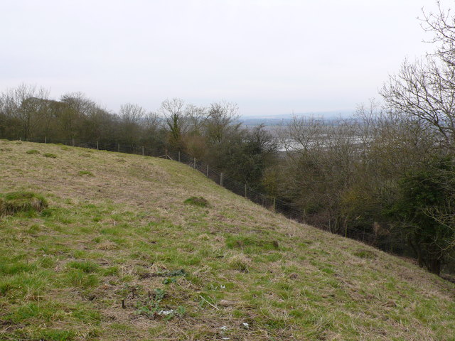
Image: © Nigel Mykura Taken: 28 Feb 2013
A small area of the hillside known as Red Hill above West Sedgemoor belongs to the National Trust and is open to the public. In the background can be seen the moor which still has some flood water on it.
Images are licensed for reuse under creativecommons.org/licenses/by-sa/2.0
Image Location
Latitude
51.031278
Longitude
-2.883671