The Ruchetmoss Burn
Introduction
The photograph on this page of The Ruchetmoss Burn by Lairich Rig as part of the Geograph project.
The Geograph project started in 2005 with the aim of publishing, organising and preserving representative images for every square kilometre of Great Britain, Ireland and the Isle of Man.

There are currently over 7.5m images from over 14,400 individuals and you can help contribute to the project by visiting https://www.geograph.org.uk
The Ruchetmoss Burn
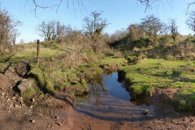
Image: © Lairich Rig Taken: 25 Feb 2013
The same section of burn is shown, viewed in the opposite direction, in Image On the left, in the present picture, and leading past the wooden post, is the footpath that is referred to in the end-note. For most of the length of the footpath, the Ruchetmoss Burn runs parallel to it, just to its south. "Ruchetmoss Burn: this small burn is named from its junction with the Carrochan Burn at Arthurston Mill to the parish road at 22 chains east of the same" [OS Object Name Book (1890s)]. In this area, Roy's Military Survey of Scotland (1740s-50s) shows some buildings and enclosures, collectively labelled Rochitmoss, which is clearly the same name. I have seen the burn referred to, in local works from the early twentieth century, as the "Rough-head Moss", a reshaping of Ruchetmoss (and perhaps a bit of folk etymology).
Images are licensed for reuse under creativecommons.org/licenses/by-sa/2.0
Image Location


Leaflet Map data © OpenStreetMap
Latitude
55.998809
Longitude
-4.561397