Vale Mill and the River Worth
Introduction
The photograph on this page of Vale Mill and the River Worth by K A as part of the Geograph project.
The Geograph project started in 2005 with the aim of publishing, organising and preserving representative images for every square kilometre of Great Britain, Ireland and the Isle of Man.

There are currently over 7.5m images from over 14,400 individuals and you can help contribute to the project by visiting https://www.geograph.org.uk
Vale Mill and the River Worth
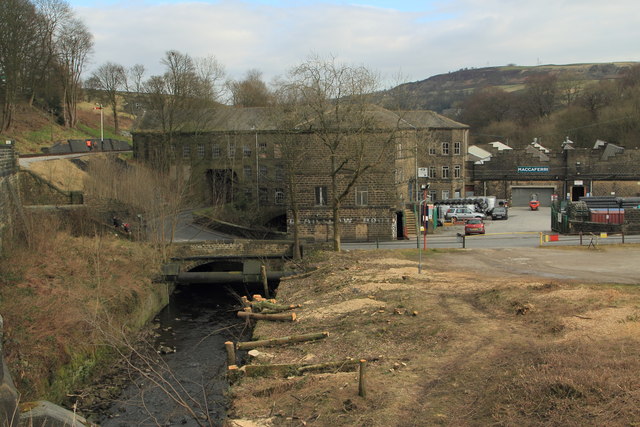
Image: © K A Taken: 2 Mar 2013
This view has been opened up recently with the felling of trees that lined the river, the remains of the felling being clearly visible. The photograph was taken from within the boundary of the Keighley & Worth valley Railway for which I have a lineside photographer's permit
Images are licensed for reuse under creativecommons.org/licenses/by-sa/2.0
Image Location
Latitude
53.840306
Longitude
-1.944038