The pub with no name?
Introduction
The photograph on this page of The pub with no name? by Phil Champion as part of the Geograph project.
The Geograph project started in 2005 with the aim of publishing, organising and preserving representative images for every square kilometre of Great Britain, Ireland and the Isle of Man.

There are currently over 7.5m images from over 14,400 individuals and you can help contribute to the project by visiting https://www.geograph.org.uk
The pub with no name?
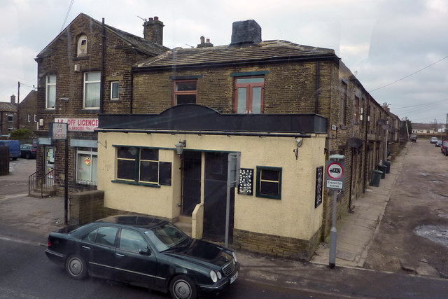
Image: © Phil Champion Taken: 1 Feb 2012
Actually formerly the West End Tavern. On the main road through Queensbury, next to JK Off Licence and Grocers. To the right is Alma Street. Google's Street View photos from August 2009 suggest the pub was then still open although the sign outside was advertising a Christmas-themed party - in July - as if to suggest that it wouldn't be around come December. When I passed that way in February 2012 the sign was blacked out and the windows too were boarded up and painted black, as if in mourning.
Images are licensed for reuse under creativecommons.org/licenses/by-sa/2.0
Image Location
Latitude
53.766167
Longitude
-1.851749