Side view of the former Seamen's Mission, Barry
Introduction
The photograph on this page of Side view of the former Seamen's Mission, Barry by Jaggery as part of the Geograph project.
The Geograph project started in 2005 with the aim of publishing, organising and preserving representative images for every square kilometre of Great Britain, Ireland and the Isle of Man.

There are currently over 7.5m images from over 14,400 individuals and you can help contribute to the project by visiting https://www.geograph.org.uk
Side view of the former Seamen's Mission, Barry
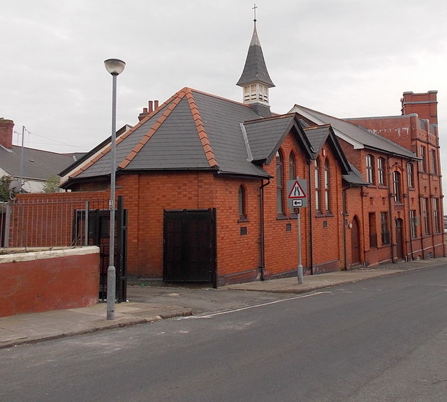
Image: © Jaggery Taken: 28 Feb 2013
This is the Castleland Road side of this http://www.geograph.org.uk/photo/1897179 building on the corner of Dock View Road, now in use as flats. The foundation stone http://www.geograph.org.uk/photo/1897190 was laid in August 1905.
Images are licensed for reuse under creativecommons.org/licenses/by-sa/2.0
Image Location
Latitude
51.403606
Longitude
-3.261023