Newton St Cyres station
Introduction
The photograph on this page of Newton St Cyres station by Derek Harper as part of the Geograph project.
The Geograph project started in 2005 with the aim of publishing, organising and preserving representative images for every square kilometre of Great Britain, Ireland and the Isle of Man.

There are currently over 7.5m images from over 14,400 individuals and you can help contribute to the project by visiting https://www.geograph.org.uk
Newton St Cyres station
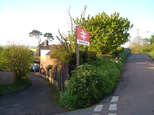
Image: © Derek Harper Taken: 5 May 2006
The turn into the station from Station Road, which continues over the railway bridge on the right. Newton St Cyres is a kilometre away across the flood plain of the Creedy, so this might more logically be named "Sweetham Station", although Sweetham is a mere hamlet. Across the road on the right is the Beer Engine http://www.geograph.org.uk/search.php?i=40100418 , thus making a train journey home convenient if you've had one too many.
Images are licensed for reuse under creativecommons.org/licenses/by-sa/2.0
Image Location
Latitude
50.779106
Longitude
-3.589395