Detail of ferry terminal buildings, Newport on Tay
Introduction
The photograph on this page of Detail of ferry terminal buildings, Newport on Tay by William Starkey as part of the Geograph project.
The Geograph project started in 2005 with the aim of publishing, organising and preserving representative images for every square kilometre of Great Britain, Ireland and the Isle of Man.

There are currently over 7.5m images from over 14,400 individuals and you can help contribute to the project by visiting https://www.geograph.org.uk
Detail of ferry terminal buildings, Newport on Tay
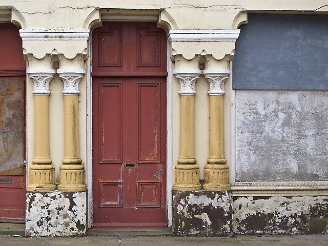
Image: © William Starkey Taken: 4 Mar 2013
Fading colours on the ferry terminal building at Newport on Tay. This building was closed in 1966 when the Tay road bridge opened.
Images are licensed for reuse under creativecommons.org/licenses/by-sa/2.0
Image Location
Latitude
56.437527
Longitude
-2.94448