St.Andrew's church
Introduction
The photograph on this page of St.Andrew's church by Richard Croft as part of the Geograph project.
The Geograph project started in 2005 with the aim of publishing, organising and preserving representative images for every square kilometre of Great Britain, Ireland and the Isle of Man.

There are currently over 7.5m images from over 14,400 individuals and you can help contribute to the project by visiting https://www.geograph.org.uk
St.Andrew's church
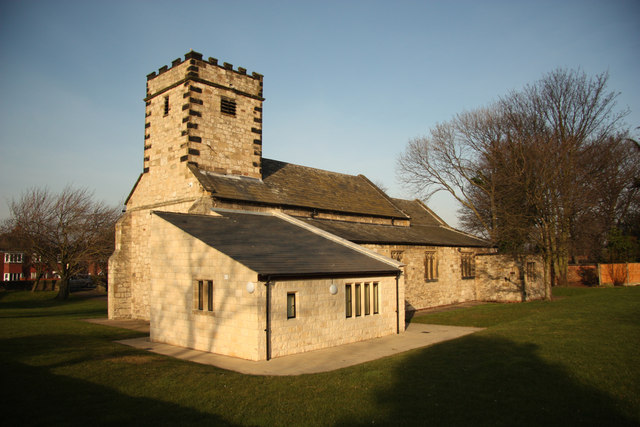
Image: © Richard Croft Taken: 28 Feb 2013
Ferrybridge parish church with a long history and fascinating story. With 11th century origins, though largely 12th, 13th & 14th century, it originally stood on a site about 400m north. The site frequently flooded and was surrounded by Ferrybridge B Power Station in the 1950s, so the whole church was moved stone by stone and rebuilt 1952-53 on this site https://historicengland.org.uk/listing/the-list/list-entry/1265111 with some alterations.
Images are licensed for reuse under creativecommons.org/licenses/by-sa/2.0
Image Location
Latitude
53.71148
Longitude
-1.273939