Bench mark on the former Wesleyan Chapel, Foxholes
Introduction
The photograph on this page of Bench mark on the former Wesleyan Chapel, Foxholes by John S Turner as part of the Geograph project.
The Geograph project started in 2005 with the aim of publishing, organising and preserving representative images for every square kilometre of Great Britain, Ireland and the Isle of Man.

There are currently over 7.5m images from over 14,400 individuals and you can help contribute to the project by visiting https://www.geograph.org.uk
Bench mark on the former Wesleyan Chapel, Foxholes
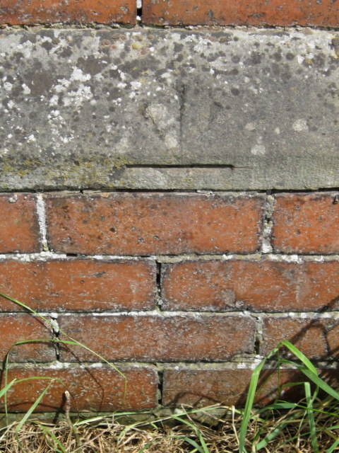
Image: © John S Turner Taken: 20 Jun 2012
This bench mark is on the west face of the former Wesleyan Methodist Chapel in Foxholes. It seems unusual in that the arrowhead is pointing downwards towards the datum line. See also Image
Images are licensed for reuse under creativecommons.org/licenses/by-sa/2.0
Image Location
Latitude
54.142961
Longitude
-0.451993