Water main valve diagram, Clifton Common
Introduction
The photograph on this page of Water main valve diagram, Clifton Common by Humphrey Bolton as part of the Geograph project.
The Geograph project started in 2005 with the aim of publishing, organising and preserving representative images for every square kilometre of Great Britain, Ireland and the Isle of Man.

There are currently over 7.5m images from over 14,400 individuals and you can help contribute to the project by visiting https://www.geograph.org.uk
Water main valve diagram, Clifton Common
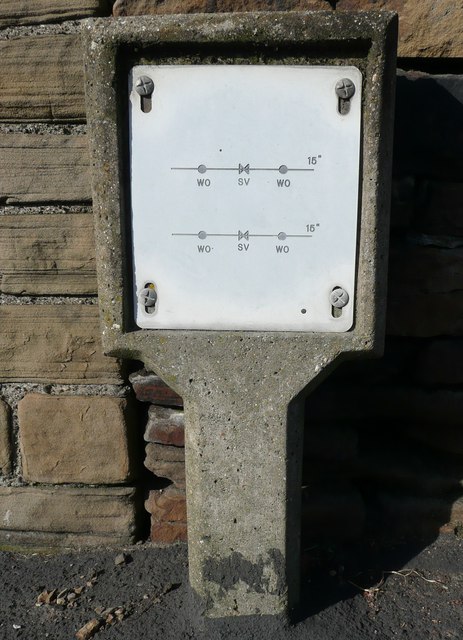
Image: © Humphrey Bolton Taken: 28 Feb 2013
I had passed this countless times before noticing it. Like a similar one at Hill Top, Gomersal, it shows two 15 inch pipes, but in this case there is no cross-connection.
Images are licensed for reuse under creativecommons.org/licenses/by-sa/2.0
Image Location
Latitude
53.704997
Longitude
-1.763801