Church of the Ascension, Pollards Hill: east end
Introduction
The photograph on this page of Church of the Ascension, Pollards Hill: east end by Stephen Craven as part of the Geograph project.
The Geograph project started in 2005 with the aim of publishing, organising and preserving representative images for every square kilometre of Great Britain, Ireland and the Isle of Man.

There are currently over 7.5m images from over 14,400 individuals and you can help contribute to the project by visiting https://www.geograph.org.uk
Church of the Ascension, Pollards Hill: east end
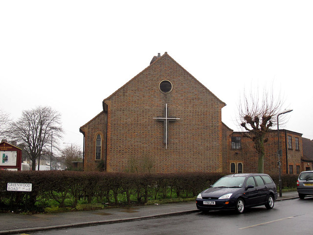
Image: © Stephen Craven Taken: 26 Feb 2013
The church is in the acute angle of the junction of Sherwood Park Road and Greenwood Road (foreground). It is an Anglican church, built in 1953 as the Ascension, Mitcham. Despite the parish's present name it is on the plain: the eponymous hill Image is actually in the parish of St Philip, Norbury.
Images are licensed for reuse under creativecommons.org/licenses/by-sa/2.0
Image Location
Latitude
51.39997
Longitude
-0.135479