Cutting by Twentywell Lane at north entrance to Bradway Tunnel
Introduction
The photograph on this page of Cutting by Twentywell Lane at north entrance to Bradway Tunnel by Chris Morgan as part of the Geograph project.
The Geograph project started in 2005 with the aim of publishing, organising and preserving representative images for every square kilometre of Great Britain, Ireland and the Isle of Man.

There are currently over 7.5m images from over 14,400 individuals and you can help contribute to the project by visiting https://www.geograph.org.uk
Cutting by Twentywell Lane at north entrance to Bradway Tunnel
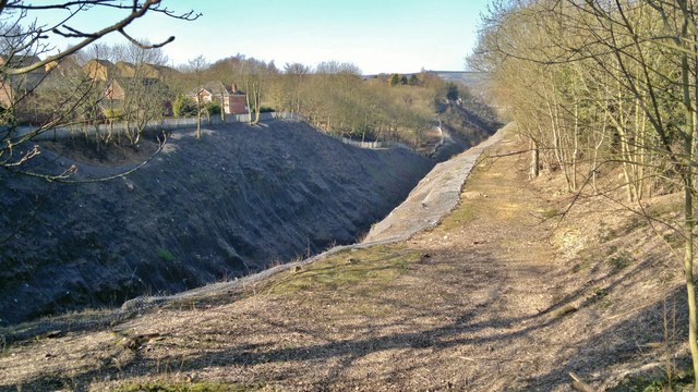
Image: © Chris Morgan Taken: 2 Mar 2013
Twentywell Lane now runs to the right of this picture. Originally, before the railway cutting was dug up to Bradway Tunnel, it followed the line shown here. The course of the old road was revealed after all vegetation was removed from the rocky sides to reduce the risk to trains running below. The sides of the cutting are now covered by a strong wire mesh netting.
Images are licensed for reuse under creativecommons.org/licenses/by-sa/2.0
Image Location
Latitude
53.323582
Longitude
-1.513842