The Confluence
Introduction
The photograph on this page of The Confluence by terry joyce as part of the Geograph project.
The Geograph project started in 2005 with the aim of publishing, organising and preserving representative images for every square kilometre of Great Britain, Ireland and the Isle of Man.

There are currently over 7.5m images from over 14,400 individuals and you can help contribute to the project by visiting https://www.geograph.org.uk
The Confluence
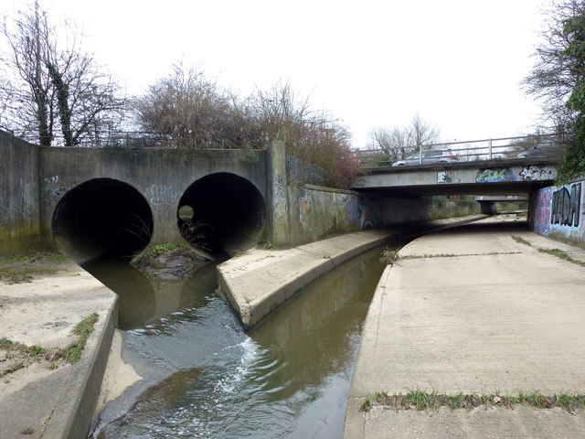
Image: © terry joyce Taken: 22 Feb 2013
The large pipes on the left are Nevendon Brook joining the River Crouch in Wickford. The pipes (culvert) flow under the roundabout on the A132. The bridge is the access road to the supermarket and car park. The second bridge is the A129 London Road.
Images are licensed for reuse under creativecommons.org/licenses/by-sa/2.0
Image Location
Latitude
51.611396
Longitude
0.523