Napierston Road
Introduction
The photograph on this page of Napierston Road by Lairich Rig as part of the Geograph project.
The Geograph project started in 2005 with the aim of publishing, organising and preserving representative images for every square kilometre of Great Britain, Ireland and the Isle of Man.

There are currently over 7.5m images from over 14,400 individuals and you can help contribute to the project by visiting https://www.geograph.org.uk
Napierston Road
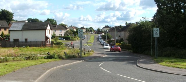
Image: © Lairich Rig Taken: 13 Aug 2010
The picture was taken from the junction with Image The area ahead is called Dalmonach (thought to signify "field of the monks"; compare Image). The green area in the foreground, to the left (north) of the road was, until recent years, the site of Napierston Farm: Image The area called Napierston was also known historically as Bonhill-Napier (there was also a Bonhill-Noble and a Bonhill-Lindsay; see Image). The land that came to be known as Bonhill-Napier or Napierston was granted to Duncan Napier by Walter, Earl of Lennox: "Walter bestowed the 'quarter' of Bonhill, lying next to the lands of Balloch, upon Duncan Napier, lord of Kilmahew, for services rendered by John Napier, his father, to Malcolm, Earl of Lennox, who was slain at Halidon Hill" [Joseph Irving in volume 2 of "The Book of Dumbartonshire" (1879)]. The battle of Halidon Hill took place in July 1333, and the grant is recorded as charter 68 in the Lennox Cartulary: "Carta terrarum de Bullul et Miltoun Duncano Naper", "charter of the lands of Bonhill and Miltoun to Duncan Nap(i)er". On the form "Bullul" for Bonhill, see Image A "Napierstoun" is shown, somewhere in this general area, on the Pont/Blaeu map of the Lennox (the map was published in 1654, but was based largely upon surveys carried out in the 1580s-90s). Roy's Military Survey (1740s-50s) likewise shows "Napierstown". By the time of the first-edition OS map (surveyed in 1860), Napierston Farm is shown here, with Woodside Farm a little further up Auchincarroch Road; that was still the case until less than a decade before this photograph was taken. When the extensive Strathleven Estate was sold off in lots in 1950, these farms made up Lot 7. In some respects, the prospectus treats them as a single entity: they are listed as "another extremely fine T.T. dairy farm known as Napierston and Woodside". The two farms latterly belonged to the same family, which accounts for the fact that there is now a prominent "Napierston Farm" sign on one of the large farm buildings of Woodside Farm. In 2007, shortly before the buildings of Napierston Farm were demolished, the area was archaeologically surveyed to determine whether there was evidence for the farm's location being at the centre of the medieval Napierston area (also known as Bonhill-Napier). No such evidence was found, but this was in line with expectations; it had been thought more likely that the core of the medieval settlement lay in what is now Bonhill (and it is probably that settlement, rather than the more recent farm, that was represented by "Napierstoun" on the Pont/Blaeu map).
Images are licensed for reuse under creativecommons.org/licenses/by-sa/2.0
Image Location
Latitude
55.992735
Longitude
-4.568212