
Remains of water-meadow water control structure
Introduction
The photograph on this page of Remains of water-meadow water control structure by Caroline Tandy as part of the Geograph project.
The Geograph project started in 2005 with the aim of publishing, organising and preserving representative images for every square kilometre of Great Britain, Ireland and the Isle of Man.

There are currently over 7.5m images from over 14,400 individuals and you can help contribute to the project by visiting https://www.geograph.org.uk
Remains of water-meadow water control structure
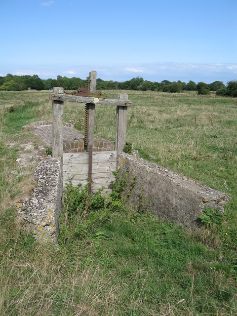
Image: © Caroline Tandy Taken: 6 Aug 2006
This area of old water-meadows next to the River Frome is scattered with these abandoned water control structures. Along with a series of ditches which criss-crossed the meadows and connected to the river, the structures were used to deliberately flood the meadows with a shallow layer of water in winter. The near-static water dropped its load of silt, hence adding nutrients to the soil, and the water kept the land warmer, encouraging early grass growth once the water was drained away in the spring. Judging by their condition and the presence of concrete, it would appear that these structures were still in use into the 20th century.
Images are licensed for reuse under creativecommons.org/licenses/by-sa/2.0
Image Location

Latitude
50.713484
Longitude
-2.414096