Culvert at west side of Peep-o-Day Lane
Introduction
The photograph on this page of Culvert at west side of Peep-o-Day Lane by Roger Templeman as part of the Geograph project.
The Geograph project started in 2005 with the aim of publishing, organising and preserving representative images for every square kilometre of Great Britain, Ireland and the Isle of Man.

There are currently over 7.5m images from over 14,400 individuals and you can help contribute to the project by visiting https://www.geograph.org.uk
Culvert at west side of Peep-o-Day Lane
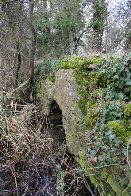
Image: © Roger Templeman Taken: 27 Feb 2013
This culvert is not for a stream but for overflow from a ditch on the east side of the lane. Ordnance Survey records indicate that a cut mark benchmark, http://www.bench-marks.org.uk/bm24225 was verified in 1973 on the west face of a culvert at this location, about 1 foot below ground level.
Images are licensed for reuse under creativecommons.org/licenses/by-sa/2.0
Image Location


Leaflet Map data © OpenStreetMap
Latitude
51.643726
Longitude
-1.288782