St Thomas, Radcliffe
Introduction
The photograph on this page of St Thomas, Radcliffe by Gerald England as part of the Geograph project.
The Geograph project started in 2005 with the aim of publishing, organising and preserving representative images for every square kilometre of Great Britain, Ireland and the Isle of Man.

There are currently over 7.5m images from over 14,400 individuals and you can help contribute to the project by visiting https://www.geograph.org.uk
St Thomas, Radcliffe
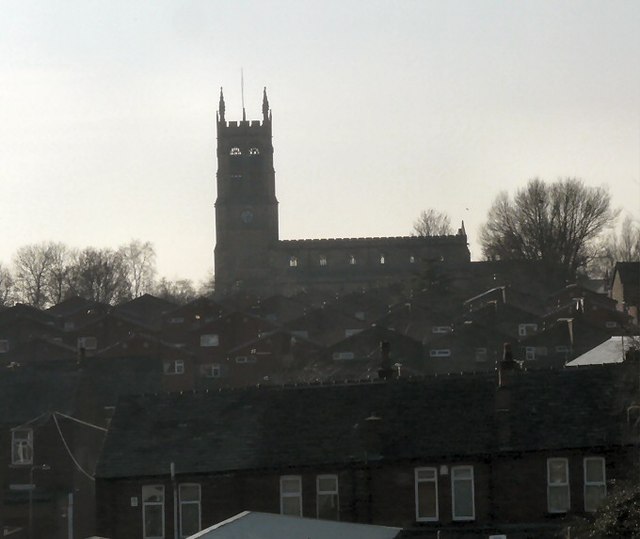
Image: © Gerald England Taken: 18 Feb 2013
The Parish church of St Thomas & St John with St Philip viewed from the metrolink tram station. The first church of St Thomas was built on the site in 1819. The church was demolished and rebuilt in 1862-4. The tower was added in 1870/71. In 1974 the parishes of St Thomas and St John were united. http://www.st-thomas-radcliffe.org/
Images are licensed for reuse under creativecommons.org/licenses/by-sa/2.0
Image Location
Latitude
53.561242
Longitude
-2.326206