Cross and church, Chagford
Introduction
The photograph on this page of Cross and church, Chagford by Derek Harper as part of the Geograph project.
The Geograph project started in 2005 with the aim of publishing, organising and preserving representative images for every square kilometre of Great Britain, Ireland and the Isle of Man.

There are currently over 7.5m images from over 14,400 individuals and you can help contribute to the project by visiting https://www.geograph.org.uk
Cross and church, Chagford
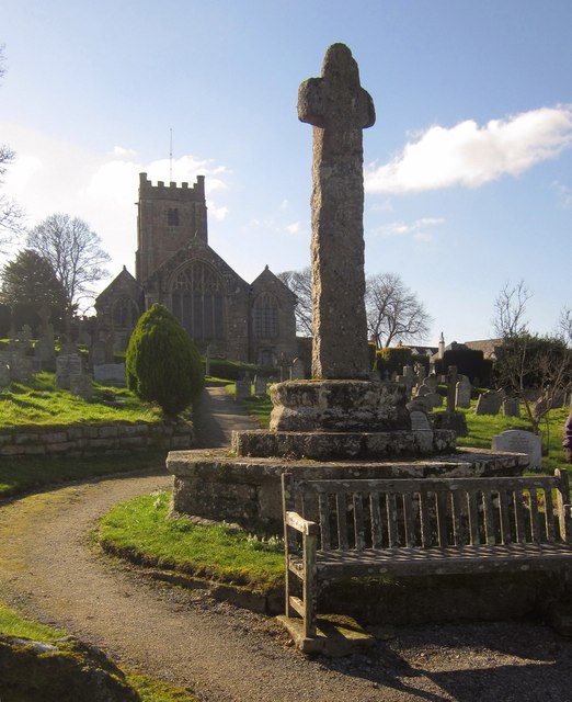
Image: © Derek Harper Taken: 17 Feb 2013
Looking up the long path through the churchyard. The cross is described at http://list.english-heritage.org.uk/resultsingle.aspx?uid=1308621&searchtype=mapsearch as " erected as a war memorial in 1928 using fragments of probably C15 crosses ... the head is medieval but the shaft is C20". For the church, see http://list.english-heritage.org.uk/resultsingle.aspx?uid=1308610&searchtype=mapsearch .
Images are licensed for reuse under creativecommons.org/licenses/by-sa/2.0
Image Location
Latitude
50.673011
Longitude
-3.838294