
Work on St Marychurch Road
Introduction
The photograph on this page of Work on St Marychurch Road by Derek Harper as part of the Geograph project.
The Geograph project started in 2005 with the aim of publishing, organising and preserving representative images for every square kilometre of Great Britain, Ireland and the Isle of Man.

There are currently over 7.5m images from over 14,400 individuals and you can help contribute to the project by visiting https://www.geograph.org.uk
Work on St Marychurch Road
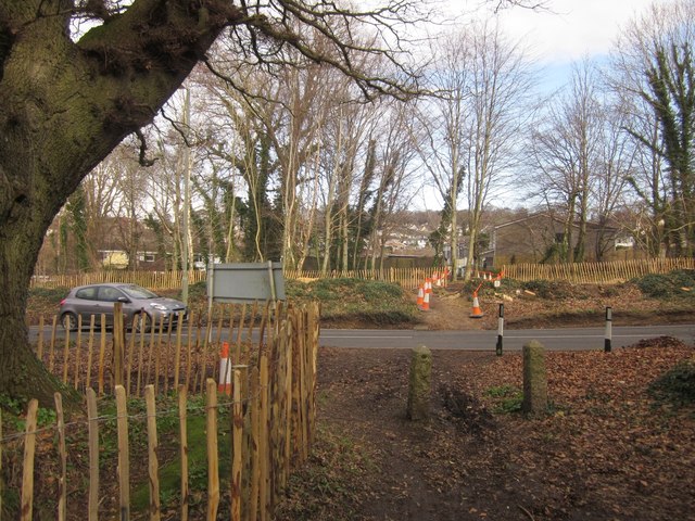
Image: © Derek Harper Taken: 16 Feb 2013
Trees have been cleared, mainly on the west side of St Marychurch Road, in preparation for changes at the junction with Aller Brake Road. A vehicular link will be created, but only for traffic heading to and from Penn Inn. (This is a consequence of the new Kingkerswell bypass; traffic will no longer be able to turn right at the bottom of Aller Brake Road). The venerable oak tree to the left of the camera, shown in Image], will survive - at least, that's the intention. Cones and tape indicate the footpath across the cleared area to and from Belgrave Road.
Images are licensed for reuse under creativecommons.org/licenses/by-sa/2.0
Image Location

Latitude
50.520919
Longitude
-3.581691