Former Derby Canal Recreational Route, Sandiacre Lock Area
Introduction
The photograph on this page of Former Derby Canal Recreational Route, Sandiacre Lock Area by David Hallam-Jones as part of the Geograph project.
The Geograph project started in 2005 with the aim of publishing, organising and preserving representative images for every square kilometre of Great Britain, Ireland and the Isle of Man.

There are currently over 7.5m images from over 14,400 individuals and you can help contribute to the project by visiting https://www.geograph.org.uk
Former Derby Canal Recreational Route, Sandiacre Lock Area
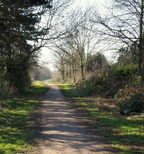
Image: © David Hallam-Jones Taken: 17 Feb 2013
This path heads off into the distance along the route of the most easterly segment of the former Derby Canal. In the 1960s the canal was sealed off beneath the Lock Lane humped-backed bridge immediately behind the photographer. It was subsequently drained and filled-in to create a recreational activity route. The Derby Canal's former "Sandiacre Bottom Lock" was located beneath the photographer's feet, whereas the former "Sandiacre Top Lock" is now buried 100 yards ahead. A farmhouse existed on the left-hand side between these former lock locations that became licensed as "The Boat Inn" in 1845. It was apparently 'closed-up' in 1940 when it was destroyed by fire.
Images are licensed for reuse under creativecommons.org/licenses/by-sa/2.0
Image Location
Latitude
52.916842
Longitude
-1.285511