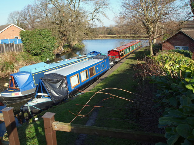
Derby & Erewash Canal Junction, Derbys.
Introduction
The photograph on this page of Derby & Erewash Canal Junction, Derbys. by David Hallam-Jones as part of the Geograph project.
The Geograph project started in 2005 with the aim of publishing, organising and preserving representative images for every square kilometre of Great Britain, Ireland and the Isle of Man.
There are currently over 7.5m images from over 14,400 individuals and you can help contribute to the project by visiting https://www.geograph.org.uk

Image: © David Hallam-Jones Taken: 17 Feb 2013
The Derby Arm ("Private") Moorings on a stump of the most easterly part of the former Derby Canal are seen here with the Erewash Canal forming the top of the T bar feature of this navigational junction. The footpath links Lock Lane bridge and Sandiacre Lock and Sandiacre Lock Cottages. During the 1960s the Derby Canal was blocked off and filled in behind where the photographer stood to take this picture, i.e. beneath the humped-back Lock Lane road bridge that is situated in front of the bows of these barges. The centre of Sandiacre is situated about 5-10 minutes away along the Erewash Canal towpath, to the left.

