Derby & Erewash Canal Junction, Derbys.
Introduction
The photograph on this page of Derby & Erewash Canal Junction, Derbys. by David Hallam-Jones as part of the Geograph project.
The Geograph project started in 2005 with the aim of publishing, organising and preserving representative images for every square kilometre of Great Britain, Ireland and the Isle of Man.

There are currently over 7.5m images from over 14,400 individuals and you can help contribute to the project by visiting https://www.geograph.org.uk
Derby & Erewash Canal Junction, Derbys.
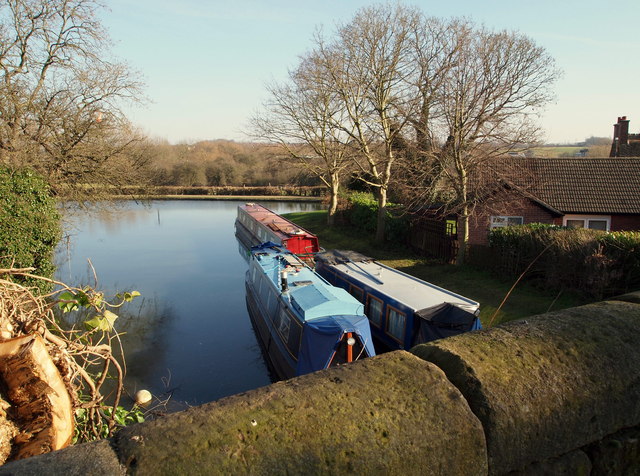
Image: © David Hallam-Jones Taken: 17 Feb 2013
The Derby Arm ("Private") Moorings. This canal stump, the most easterly part of the former Derby Canal, is seen here joining the Erewash Canal ahead. The canal was blocked-off beneath this road bridge in the 1960s and the canal filled in to provide a walking and cycling trail. Sandiacre Lock is situated behind the chimney visible in the picture, the chimney belonging to one of the now preserved Sandiacre Lock Cottages. This bridge carries traffic on Lock Lane towards Longmoor Lane (the B6002) to the left and to Sandiacre Lock to the right. The centre of Sandiacre lies further along the Erewash Canal, to the left.
Images are licensed for reuse under creativecommons.org/licenses/by-sa/2.0
Image Location
Latitude
52.9172
Longitude
-1.285207