St Lawrence Cricket Ground, Canterbury
Introduction
The photograph on this page of St Lawrence Cricket Ground, Canterbury by David Anstiss as part of the Geograph project.
The Geograph project started in 2005 with the aim of publishing, organising and preserving representative images for every square kilometre of Great Britain, Ireland and the Isle of Man.

There are currently over 7.5m images from over 14,400 individuals and you can help contribute to the project by visiting https://www.geograph.org.uk
St Lawrence Cricket Ground, Canterbury
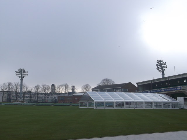
Image: © David Anstiss Taken: 17 Feb 2013
This is the home of Kent County Cricket Club. It is one of the oldest grounds on which first-class cricket is played, having been in use since 1847. On the right is the Frank Woolley Stand. In the background overlooking the ground is Image
Images are licensed for reuse under creativecommons.org/licenses/by-sa/2.0
Image Location
Latitude
51.267089
Longitude
1.090615