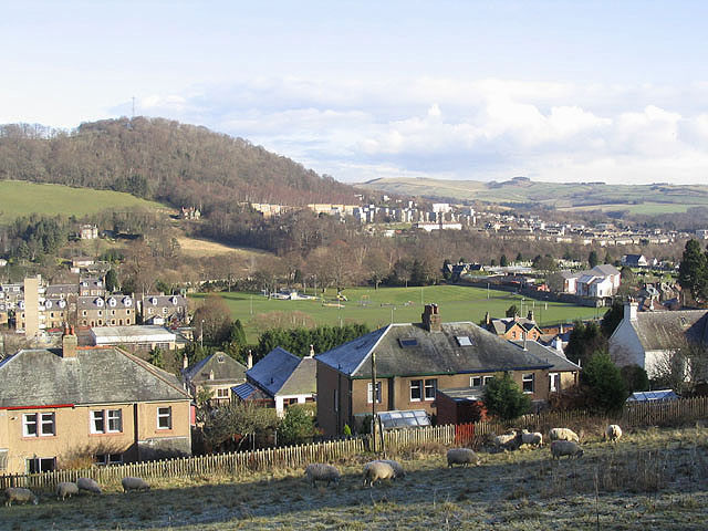
The Public Park and the southeast end of Galashiels
Introduction
The photograph on this page of The Public Park and the southeast end of Galashiels by Walter Baxter as part of the Geograph project.
The Geograph project started in 2005 with the aim of publishing, organising and preserving representative images for every square kilometre of Great Britain, Ireland and the Isle of Man.
There are currently over 7.5m images from over 14,400 individuals and you can help contribute to the project by visiting https://www.geograph.org.uk

Image: © Walter Baxter Taken: 7 Feb 2007
Viewed from the Southern Upland Way track on Barr Road below Gala Hill. The Public Park in the centre of the photo (originally laid out in 1885) has a football pitch, play area and skate board area. Eastlands cemetery is beyond (out of view) and to the right of the park. The houses in the foreground are in Oatlands Terrace while the houses centre and right in the background are in Langlee Estate. The hill on the left with communications mast is Wester Hill with Langlee Woodlands below. The field on the left below Langlee Woodlands is part of a 12.72 hectare site at Crotchetknowe, zoned for new housing. The flat roofed building with tower in the middle ground left is Galashiels fire station on Abbotsford Road.

