Sandiacre Old Village, Derbys.
Introduction
The photograph on this page of Sandiacre Old Village, Derbys. by David Hallam-Jones as part of the Geograph project.
The Geograph project started in 2005 with the aim of publishing, organising and preserving representative images for every square kilometre of Great Britain, Ireland and the Isle of Man.

There are currently over 7.5m images from over 14,400 individuals and you can help contribute to the project by visiting https://www.geograph.org.uk
Sandiacre Old Village, Derbys.
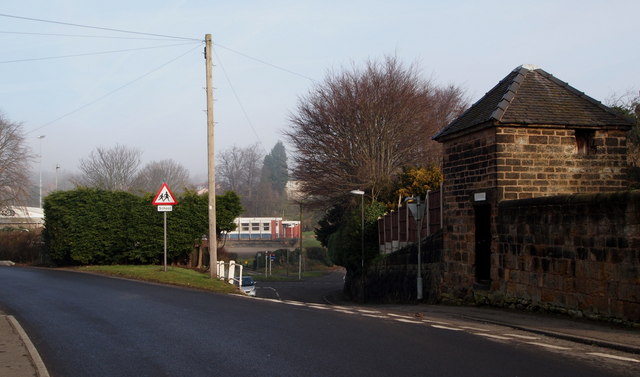
Image: © David Hallam-Jones Taken: 16 Feb 2013
The Blue Bell pub, Church Street lies was behind the photographer's left shoulder. Church Street bends to the left here and becomes Stanton Road whilst Church Drive is seen descending towards the church in front of the 17th century stone lock-up and pound for stray animals. The single storey building beyond the junction in the dip is the St Giles' Parish Hall.
Images are licensed for reuse under creativecommons.org/licenses/by-sa/2.0
Image Location
Latitude
52.928904
Longitude
-1.288288