Arlington House, All Saints' Avenue, Margate
Introduction
The photograph on this page of Arlington House, All Saints' Avenue, Margate by David Kemp as part of the Geograph project.
The Geograph project started in 2005 with the aim of publishing, organising and preserving representative images for every square kilometre of Great Britain, Ireland and the Isle of Man.

There are currently over 7.5m images from over 14,400 individuals and you can help contribute to the project by visiting https://www.geograph.org.uk
Arlington House, All Saints' Avenue, Margate
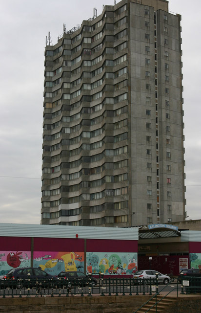
Image: © David Kemp Taken: 16 Feb 2013
Arlington House was built in the 1960s and in its early years presided majestically over crowded sandy beaches and a thriving seaside town. But tastes have changed in both architecture and leisure and today the block is surrounded by little more than a derelict shopping arcade.
Images are licensed for reuse under creativecommons.org/licenses/by-sa/2.0
Image Location
Latitude
51.386152
Longitude
1.374932